After a punishing John Muir Trail hike the previous day, we decided to take it easy and confine our walks to the valley floor.
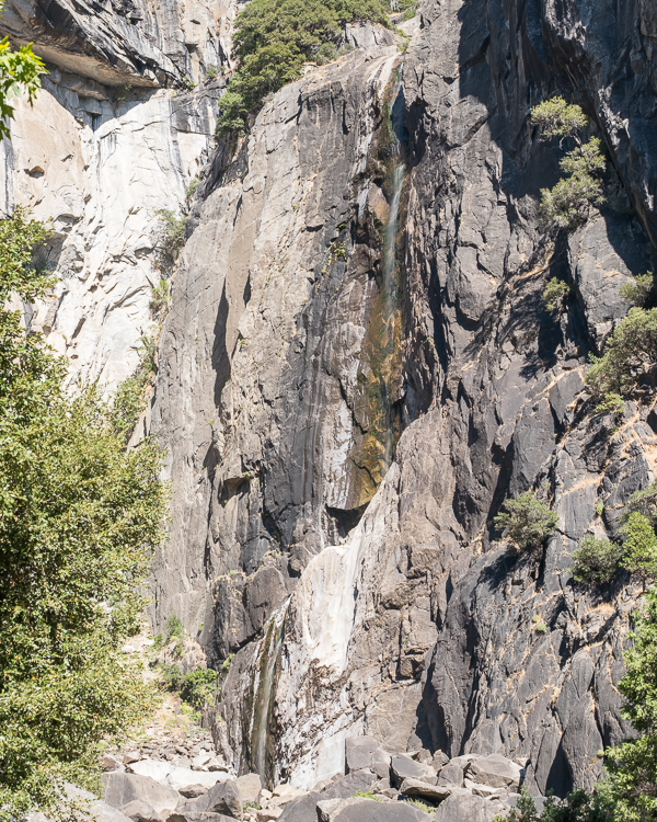
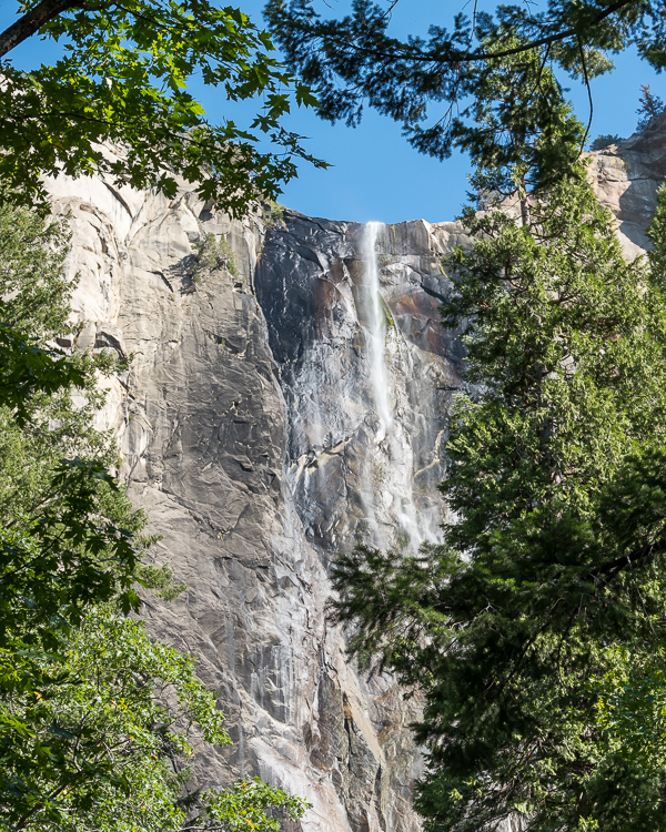
Across from the Yosemite Valley Lodge is the Lower Yosemite Falls Trail, a 1.2 mile flat and paved loop. At this time of year Yosemite Falls is basically dry. There was a trickle of water visible at the lower falls, but that was it. Still a reasonably decent walk, though.
From there it was a short walk over to the Ansel Adams Gallery. You can still purchase photographs printed by Ansel Adams himself, for the price of a small car. Or, like most visitors, you can treat the gallery like a museum.
On the way back to the lodge we decided to walk the Cook Meadows loop, another 1.0 mile, flat easy walk. Unfortunately we were walking late morning in full sun, so there was really nothing to see.
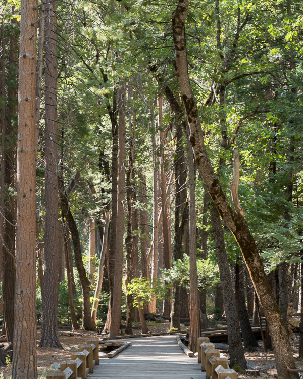
If you want some easy strolls with great views, there are a lot of sidewalks and trails throughout the valley floor to just wander. Just watch out for the bicycles on the paved portions.
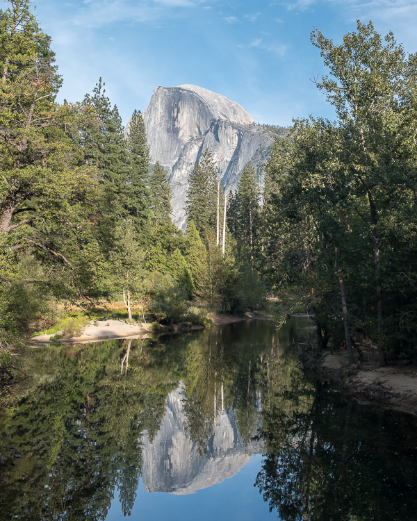
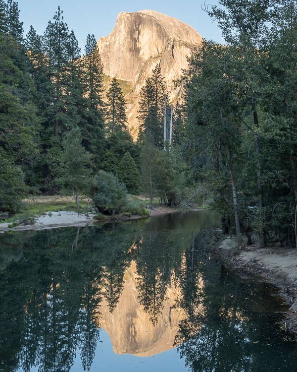
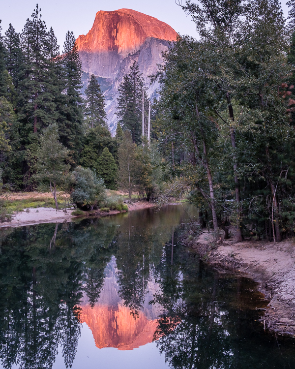
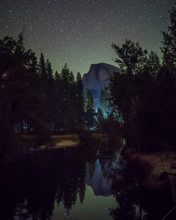
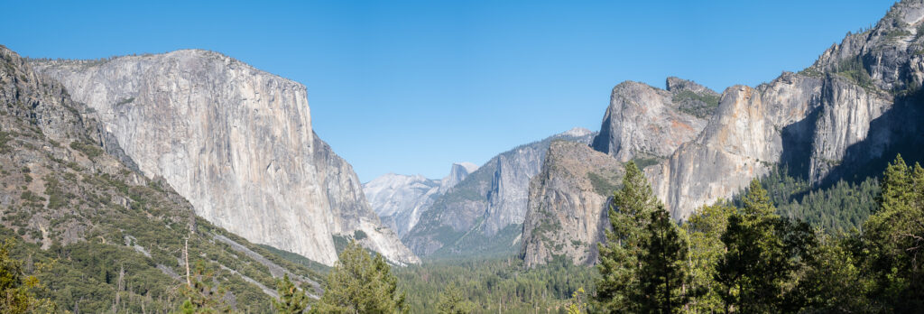
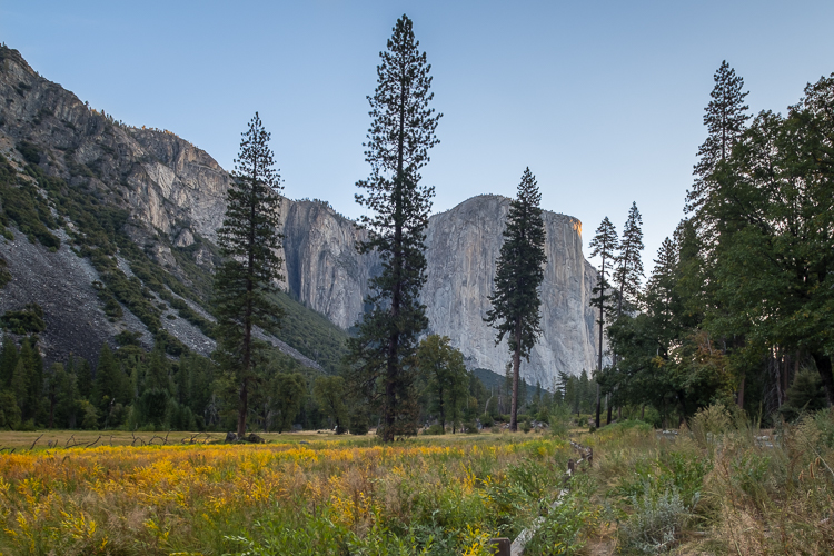
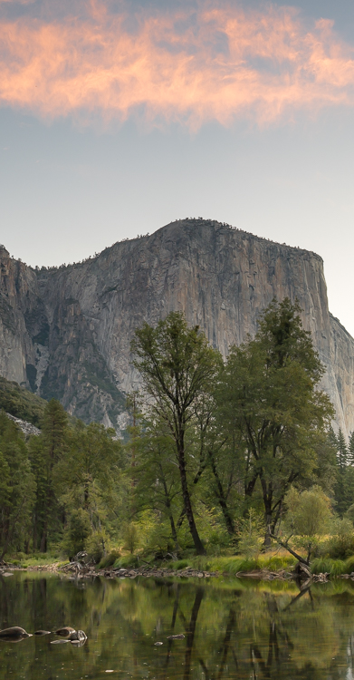
That afternoon we drove to Tunnel View, perhaps the most famous viewpoint in Yosemite Valley. I’ve seen a lot of fantastic photographs taken from this spot, of beautiful sunrises, sunsets, and incredible storms. On a full sun, blue sky day, not so much. But it is good for photographing stars on a clear night.
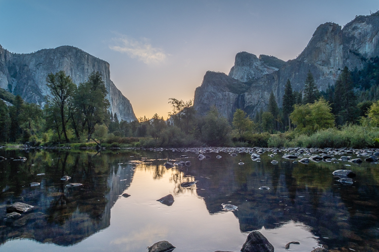
Bridalveil Falls is one of two waterfalls in the valley that flow year round, the other being Vernal Falls (and Nevada Falls). The trail to the falls can be accessed from either the designated parking lot off Wawona Road or Southside Drive.
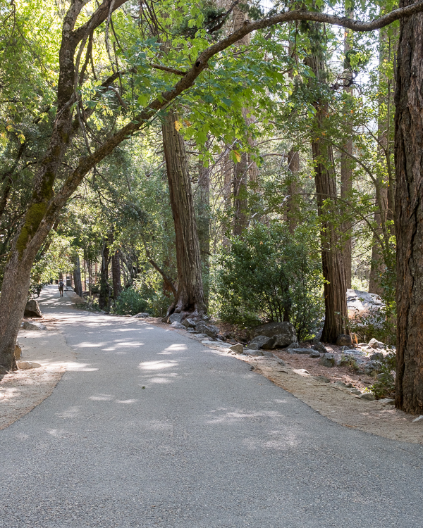
We stopped here on our way back from Tunnel View and made the short roundtrip walk to the viewing area before taking the trail to the bridges over the creeks flowing from the falls (Bridalveil Creek splits into three streams below the falls). This is a nice, shady, paved walking trail.
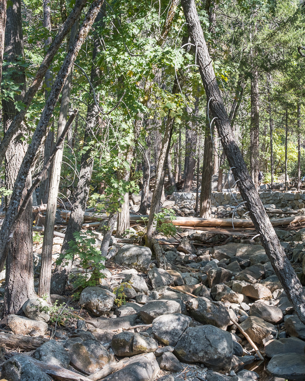
Several of the more adventurous types went rock hopping from the viewing area to the pools directly below the falls. Years ago that would have been me. Now when I see large boulders my first thought is sprained ankles and broken legs.
On our final day in the park we made the one hour drive to Glacier Point for sunset. Along the way we stopped to hike the 2.2 mile out and back trail to Taft Point. This is a really easy hike, just rolling hills until the end where there is a short downhill.
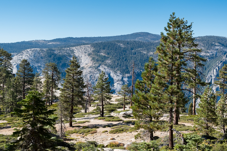
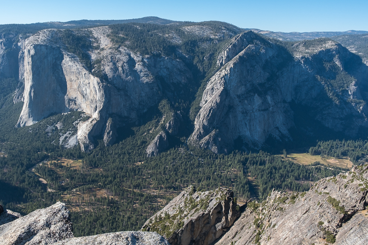
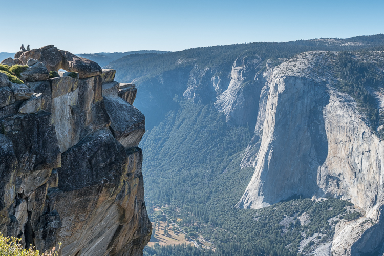
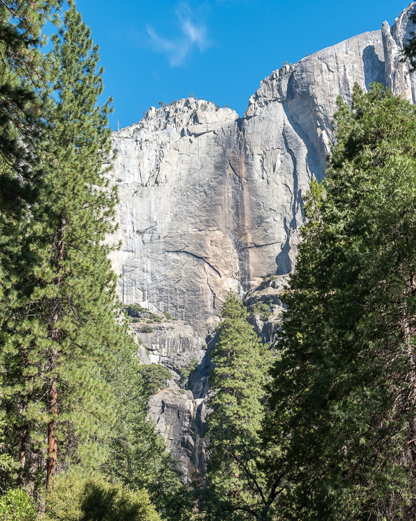
Taft Point is high above the valley floor with great views of El Capitan. Because of the near sheer drop off at the edge, there are also great views looking down, if you like heights.
Along with the Lamoille Lake Trail in the Ruby Mountains Wilderness and the Terrace Lake / Shadow Lake Trail in Lassen Volcanic National Park, this is one of our favorite hikes on the trip.
I read beforehand that Taft Point is a popular location for wedding photographs, which really surprised me given how far away it is from any city of a decent size. Yet sure enough, on our hike we ran into a full wedding party getting photographs taken: multiple photographers; bride; groom; bridesmaids; groomsmen; parents; and so on. All walking on a dirty trail fully dressed up. Okay.
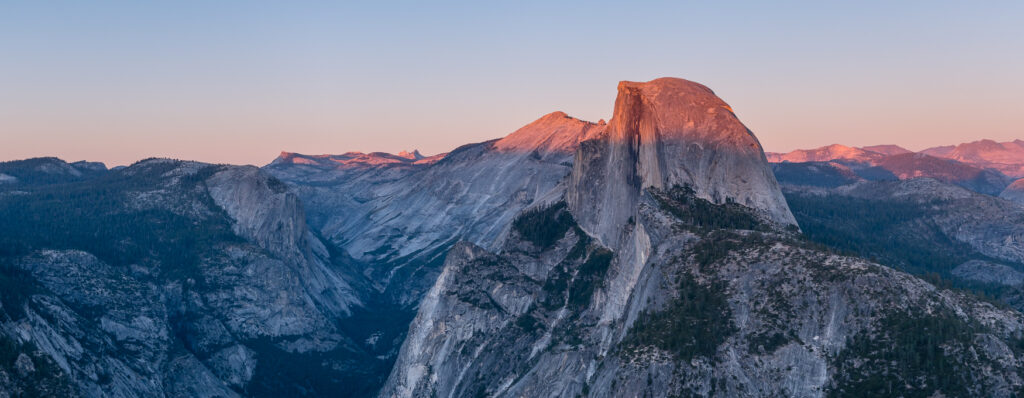
From Taft Point it is a short drive to Glacier Point, our destination for sunset. This is an incredibly popular sunset location. We arrived close to an hour beforehand and the parking lot was already mostly full. The parking lot here is very large by Yosemite standards, but seemingly still not quite large enough. Somehow we lucked into one of the closest parking places to the trail.
A shop selling snacks and gifts is there as well, but it was closed for the day by the time we arrived.
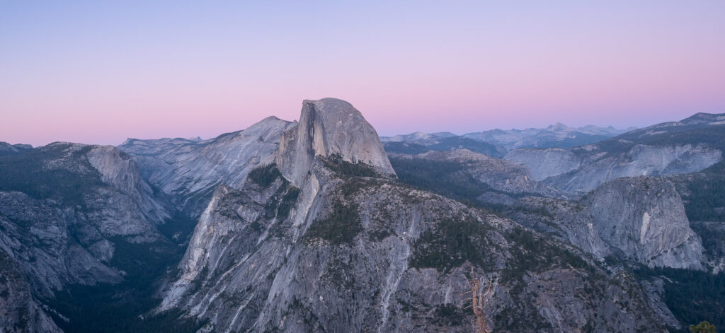
The actual trail to Glacier Point is a paved 0.5 mile roundtrip walk. It is by far the most crowded walking path that we have been on during this entire trip. Several viewing areas are established, with great views of Half Dome, the surrounding high Sierra peaks, Nevada Falls, and the valley below. We found a place that we liked and just stood there for 30 to 40 minutes watching the sunset. Along with tons of other people. It would have been much better had there been some clouds in the sky, but oh well.
Though we spent four days at Yosemite it feels like we just scratched the surface of what the park has to offer. Perhaps we will return one day in the spring or early summer while the waterfalls are at full flow. And there are a lot of hiking trails I’d like to try, particularly in the high Sierras.
For now, it is time to move on. To more big trees. Kings Canyon and Sequoia National Parks are our next destination.
Hiking in Yosemite National Park (part II), 6.1 miles:
Lower Yosemite Falls Trail, 1.2 miles
Cook Meadows Loop Trail, 1.0 mile
Bridalveil Falls Trail, 0.7 miles
Taft Point Trail, 2.2 miles
Glacier Point Trail, 1.0 mile (we walked it twice)
Garrett and Stephanie
If you missed it, here Yosemite National Park, California (September, 2024, Part I).
To read more about our adventures in national parks and state parks, or elsewhere in the world, check out our Travel Blog. It contains collected links to all of our travel posts.
Want to subscribe (or unsubscribe) for email notification of new blog posts? It is only two to three emails a month. Send your name and email address to slowtravelchronicles@gmail.com, and note subscribe (or unsubscribe) in the subject line. All email addresses will be kept confidential and not sold to any third-party. You won’t get any marketing junk or sales pitches from us.