After leaving Lassen Volcanic National Park we made a short stop in South Lake Tahoe before continuing to Yosemite National Park.
We entered the park from the east on Tioga Road. Because it was a Monday, after the worst of the busy season, we did not need a reservation to enter (though reservations were still required for entry on the weekends). We breezed through the entrance station in no time.
Our plan was to take our time exploring the sites along Tioga Road, keeping in mind that we wanted to reach the Yosemite Valley Lodge (just under a two hour drive from the Tioga Pass Entry Station) before dark.
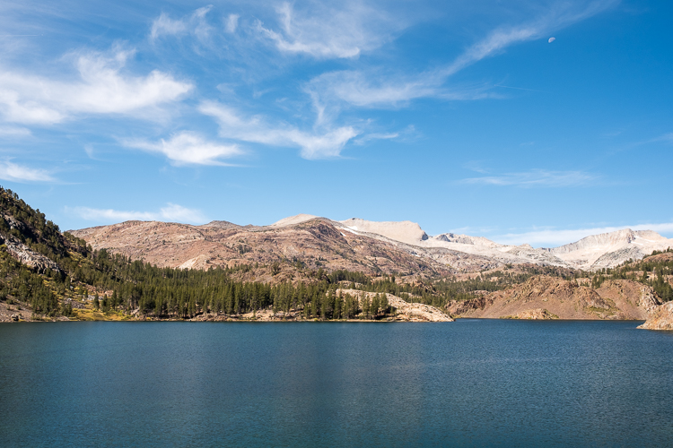
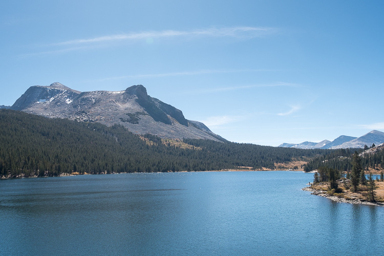
Just prior to entering the park we made quick stops at Ellery Lake and Tioga Lake. From there it was off to the Tuolumne Meadows area.
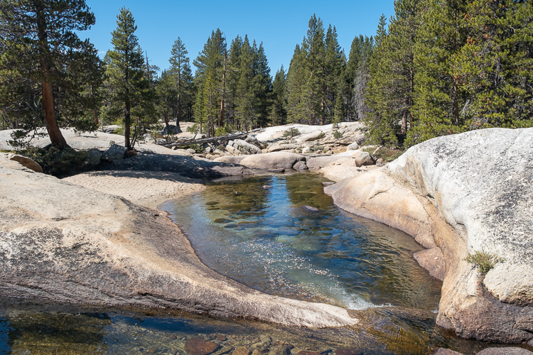
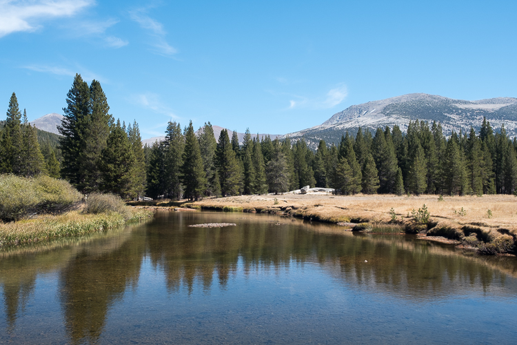
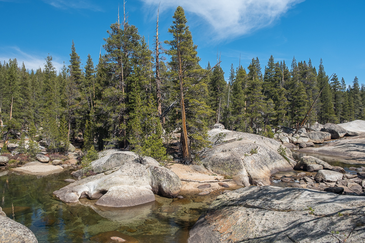
To stretch our legs after the morning drive we completed the relatively short Lyell Fork hike. At about 2.5 miles out and back, this hike starts at the Lyell Canyon Trailhead. Instead of picking up the John Muir Trail / Pacific Crest Trail into Lyell Canyon, we took a sharp left turn just after the second bridge crossing and followed a well worn trail along the bank of the Lyell Fork of the Tuolumne River.
This particular trail is not found on the Yosemite brochures or national park website, but is on Alltrails. If you want an easy, relatively flat hike in this area of the park, this is a great option.
We next stopped at the Lembert Dome picnic area for lunch before making a pit stop at the Tuolumne Meadows Visitor Center. Other than to use the restrooms, there’s not much reason to stop there. The center is really small and basic, with little to see.
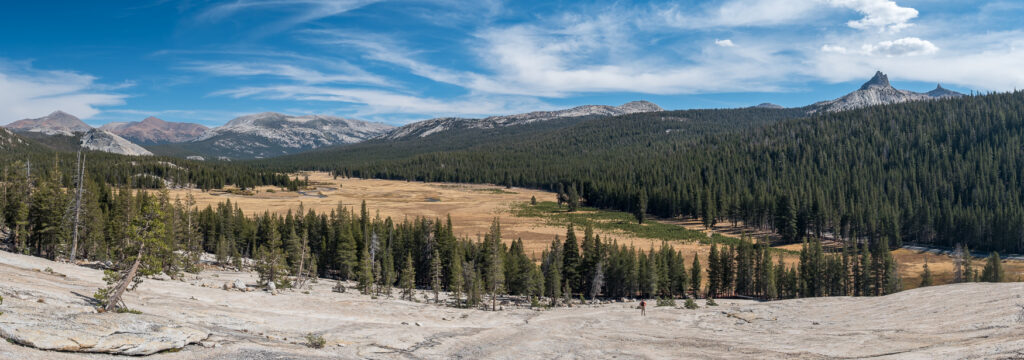
Continuing west on Tioga Road we pulled over at Pothole Dome and decided to walk up it. Well, we went up about 70% of the way. The views of the meadows and surrounding mountains were fantastic, so we did not see a real need to walk up any higher.
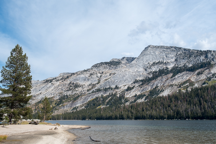
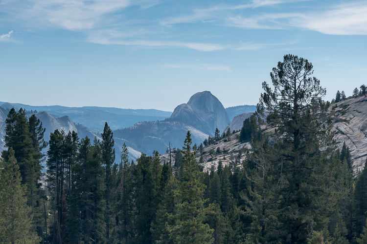
By this point in the afternoon we did not have time for any more real hiking on the way to Yosemite Valley, so we limited ourselves to stopping at a couple of quick viewpoints, Tenaya Lake and Olmstead Point, where we got our first glimpse of half dome.
Tioga Road reminds me of Grand Canyon’s North Rim, awesome scenery with only a fraction of the crowds.
We arrived at Yosemite Valley Lodge and got settled in as darkness arrived. Visitors are asked to not leave anything that has a scent in their car overnight, as a way of preventing inquisitive bears from breaking and entering. So for the first time on this trip we unpacked the car in its entirety. Thankfully the rooms are a decent size so space was not an issue.
Wi-fi around the lodge is spotty and slow, basically sufficient to browse websites, but not really good for uploading or downloading anything. Don’t plan on needing it.
For dinner we walked over to Base Camp Eatery, basically the food court. The menu is a variety of basics, notably burgers, chicken, hot dogs, fries, pizza, gyros, mediterranean bowls, cokes, and beer. The food was surprisingly good. Seriously. The portions sizes were just right and the prices reasonable ($25 for two). This was the exact opposite of what we expected.
Our exceptionally low expectations for the food court were greatly surpassed. We figured that the food was about 25% better than we thought it be, as well as being priced 25% lower.
Let’s not get carried away though. Much better than expected doesn’t make it great, just pretty good. Either way, we could not have been happier with the food court.
Also at the lodge are a Starbucks, a fancy restaurant, and a bar/lounge restaurant, none of which we visited. I would have rather bought a frozen or prepackaged meal at the gift shop than pay some of the prices at those places.
Early the next morning we drove over to the hiker’s parking lot on our way to hike the Mist Trail. Our other option was riding the shuttle bus from the lodge to the trailhead, but we viewed the bus as emergency transportation only. There is nothing wrong with taking the bus – if you want to drive around the entire valley for an hour or more. No, thanks.
One of the reasons we came to Yosemite mid-week at the end of September, rather than in the summer, is to avoid the crushing crowds that necessitate busses.
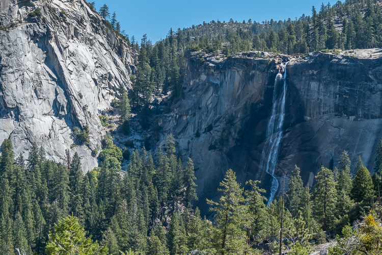
We parked our car about 8:00 AM and walked about a half mile to the trailhead. There we were greeted with a sign advising that the Mist Trail to Vernal Falls is closed during the week for repairs. Hmmm. With the Mist Trail being closed, hikers are being routed onto the John Muir Trail (“JMT”) instead. Looks like we are going to Clark Point.
At the footbridge I overhead a ranger comment that Clark Point is 500 feet higher up than Vernal Falls. So we’re on a longer trail than expected with more elevation gain than desired. Okay then.
While the Mist Trail was going to be difficult enough, I really did not know what to expect going up the JMT instead. We quickly learned that it is seriously steep, just continuous switchbacks from the footbridge to Clark Point. With a lot of traffic. I was surprised how busy it was for a Tuesday morning.
Elevation does not particularly bother me, but Stephanie can only handle so much of it. This hike definitely tested her limits. So we took our time and went slow. Very slow. It took us about three hours to reach Clark Point and another two and a half hours to get back down, also going slowly.
At one point we considered going to Vernal Falls from Clark Point, but that idea was quickly scrapped after learning it would add another 500 feet in elevation.
On the way down, we overheard some girl tell her boyfriend that they were stopped at switchback five of seven. You could tell she was trying to encourage him to keep going. What she said was true if you take the trail map printed by the park literally. I didn’t have the heart to tell her that it was all switchbacks on the way up, many many more, and that the map, which suggests a lateral walk across the side of the mountain after seven switchbacks, is wrong. We learned that the hard way too.
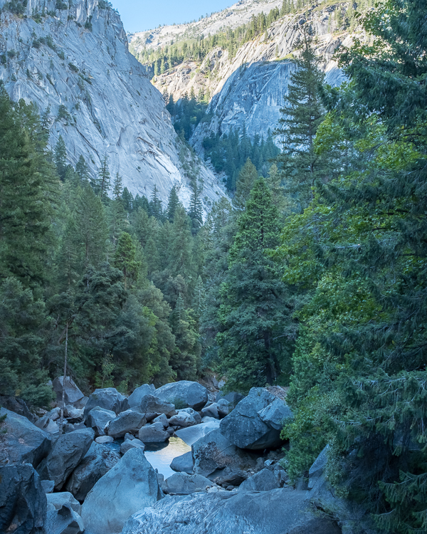
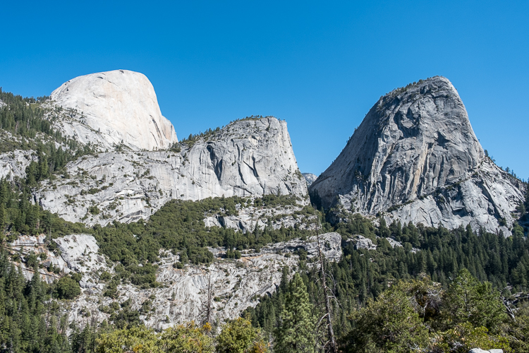
As it turns out, the round-trip hike was about 4.5 miles (not bad) and 1,600 feet of elevation (ouch). Add on another mile going from and to the hiker’s parking lot. But Clark Point is beautiful and definitely worth the hike, probably even more than Vernal Falls.
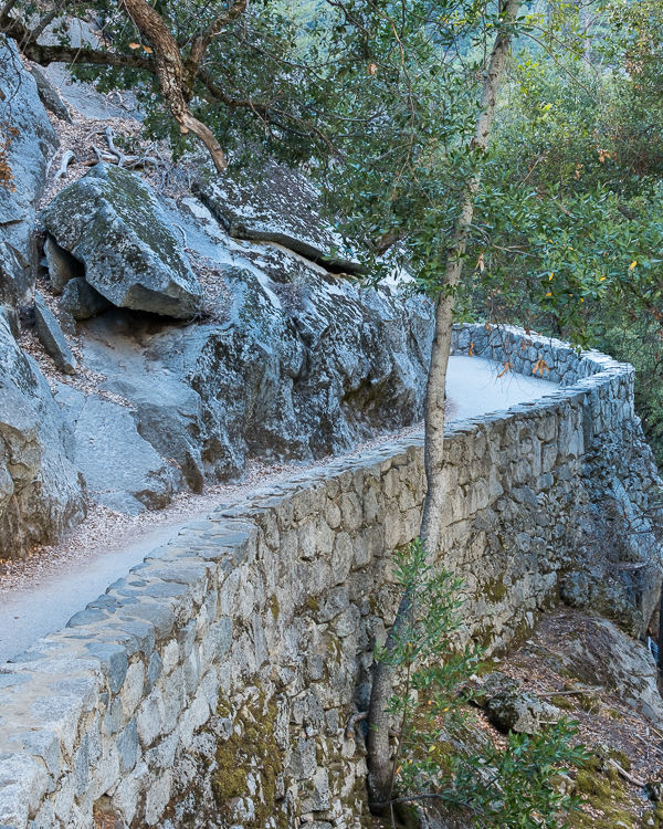
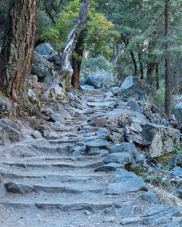
But, and I may be in the minority here, I absolutely hated the trail itself. The first third is paved. After that the JMT was apparently paved at one time, now it’s a mix of badly eroded pavement, large rocks, and dirt, all covered by a fine dusting of gravel. We did not see anyone fall, but everyone slips at some point.
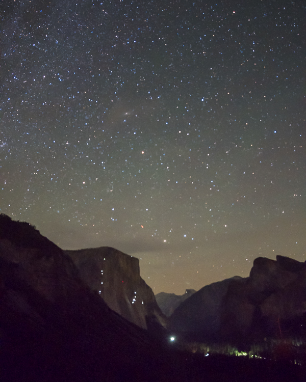
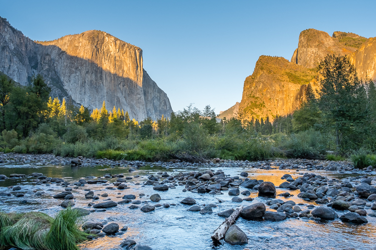
After a late lunch and recuperating in our room at the lodge for a bit, we ventured out to view sunset before calling it a day.
Hiking in Yosemite National Park (part I), 9.0 miles:
Lyell Fork Trail, 2.5 miles
Pothole Dome Trail, 1.0 mile
John Muir Trail to Clark Point, 5.5 miles
Garrett and Stephanie
To continue, here is Yosemite National Park, California (September, 2024, Part II).
To read more about our adventures in national parks and state parks, or elsewhere in the world, check out our Travel Blog. It contains collected links to all of our travel posts.
Want to subscribe (or unsubscribe) for email notification of new blog posts? It is only two to three emails a month. Send your name and email address to slowtravelchronicles@gmail.com, and note subscribe (or unsubscribe) in the subject line. All email addresses will be kept confidential and not sold to any third-party. You won’t get any marketing junk or sales pitches from us.