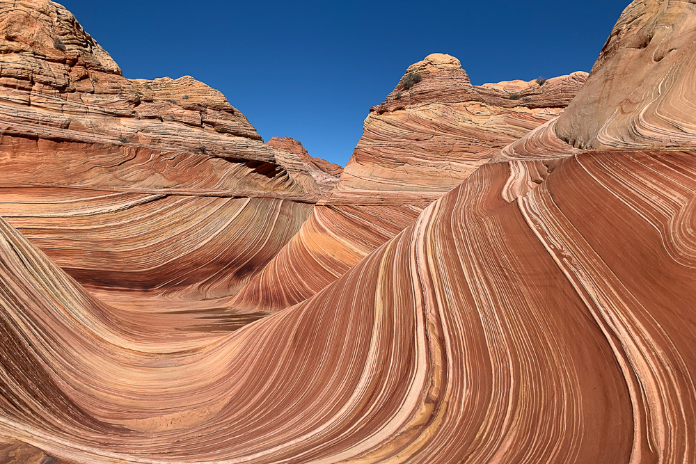
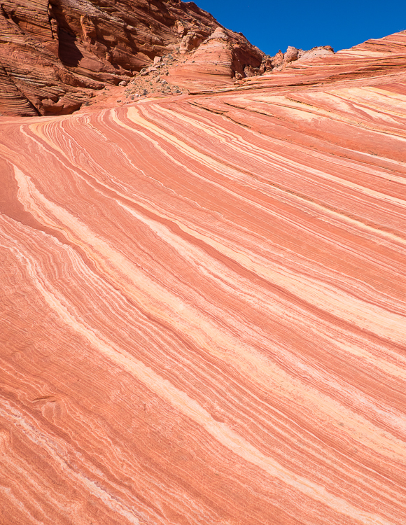
The Wave, an iconic sandstone feature, is located in the Coyote Buttes North section of Vermilion Cliffs National Monument in Arizona. This is my bucket list adventure on this trip. While Stephanie wanted to get up before dark to go to the Albuquerque Balloon Fiesta (blog post here), I wanted to hike miles across the desert to see yet another rock.
A Coyote Buttes North permit, issued by the Bureau of Land Management (“BLM”), is one of the most coveted and difficult to obtain hiking permits. For decades a maximum of 20 permits per day were issued by the BLM. In 2021, the number of daily permits jumped to a maximum of 64.
To obtain a permit, enter the online lottery on Recreation.gov, held four months in advance, in which 12 groups (up to 48 people) win permits. A second lottery is conducted each day, awarding permits to 4 groups (up to 16 people) one day prior to their hike.
Somehow or another, we won the advance online lottery. On July 1, 2022, I received an email from Recreation.gov with the subject line “Coyote Buttes North (The Wave) Lottery Results Announcement – Congratulations!”. Wow! I’ve never been so happy to pay money for winning a lottery. The actual permit costs $7 (per person), in addition to the $9 application fee (per group, non-refundable).

In case you are wondering, the odds of winning a permit are now between 3% and 8%, depending upon the day and month. Hundreds of thousands of people apply for a Coyote Buttes North permit each year.
We met a group of three hikers that applied for a permit via the online lottery every single month for three years before winning. At $9 per application, they spent $324 in fees to win a permit. Stephanie gleefully told them that we applied only twice in the past three years and won once. She wasn’t rubbing it in; they asked how many times we applied.
Park Rangers and volunteers check permits at the trailhead and again randomly during the hike. Get caught in Coyote Buttes North without a permit and the fine can run into the thousands of dollars.


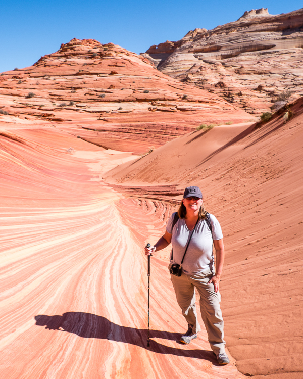
The hike to The Wave, 6.4 miles round trip, is fairly easy, particularly in cool weather. In the summer it is likely brutal as there is little to no shade on the trail. Actually, there is no trail for most of the way. The hike is unmarked, and largely takes place over uneven sandstone, tilted between 5 degrees to 25 degrees, if not more.
Your ankles will find ways to move in directions you did not know was possible. If you are not used to walking on seriously uneven surfaces (who is?), it can be slightly painful at times. Hiking poles are a good idea.
The elevation gain is a manageable 335 feet (per AllTrails), though it is possible to climb hundreds of feet higher on rock formations immediately above The Wave.

For our hike to The Wave we hired a guide with Dreamland Safari Tours, a local company in Kanab, Utah, that we have used several times for hikes and tours in this area – highly recommended! (see FN 1.) We did so for three reasons:
1) a not insignificant number of people who obtain a permit cannot find The Wave. In the past it was estimated that 30% of folks missed The Wave. That figure supposedly decreased to 10% since the BLM gave out better directions on how to find it.
2) the trailhead is eight miles down a dirt road. In good times the road is supposedly passable in a passenger car. Other times a high clearance vehicle with offroad tires is needed. The last thing we wanted was a flat tire or other car problem preventing us from even getting to the trail; and,
3) as a general insurance policy in case of a medical emergency.
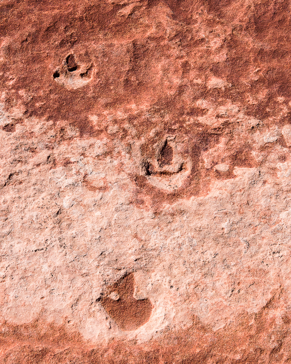
We started our hike at 9:30 AM, finishing at 4:00 PM. Along the way back from The Wave, our guide took us on the “loop” to see, among other sights, the “Second” Wave, the boneyard, and dinosaur tracks, adding more than a half mile to the straight out and back trek.
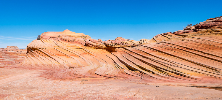
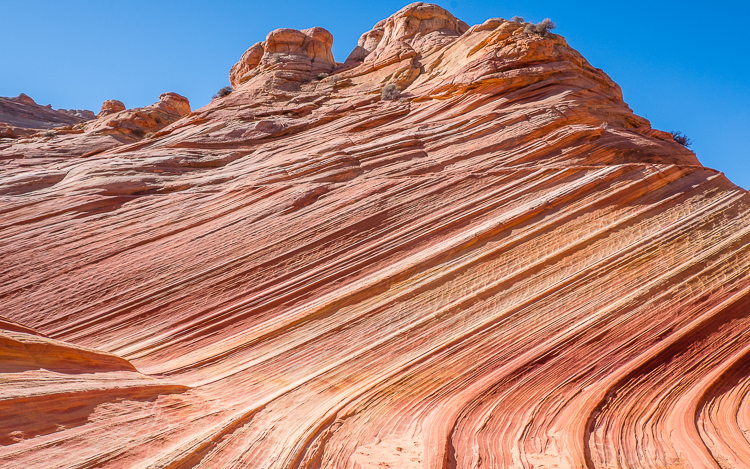
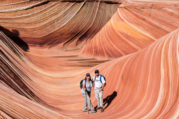
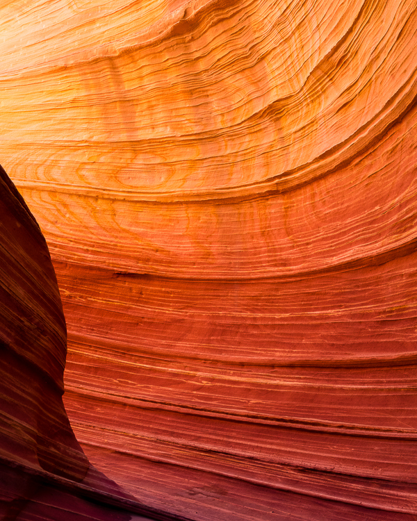
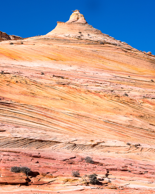
It was an exceptional hike. The sandstone formations are awesome. Wear polarized sunglasses, as it makes the colors pop, a kaleidoscope of red, orange, yellow, purple, and white. Photography tip – sandstone looks more brilliant, and much different, in reflected sunlight rather than direct sunlight.
At The Wave we probably saw about 10 to 15 other people at any one time. Thankfully everyone was polite and considerate so that photographs and video could be taken. During the course of the entire hike we probably came across about 40 other people total.
If you are in the area and cannot obtain a permit to hike Coyote Buttes North, your second choice should be to try for a Coyote Buttes South permit. Coyote Buttes South is supposedly as or more beautiful than Coyote Buttes North, but without access to The Wave. Unfortunately, Coyote Buttes South permits are also very difficult to get.
Alternatives that do not require a permit include Wire Pass and Buckskin Gulch (long, narrow slot canyons), Peekaboo Canyon, Yellow Rock (yes, a giant yellow rock) and White Pocket, a large white rock formation in Vermilion Cliffs National Monument that is outside of the Coyote Buttes permit area.
Really there are so many incredible hikes to take in southeast Utah that there is something for everyone. At least everyone with a four-wheel drive, high clearance truck, outfitted with off-road tires (i.e. not a Jeep rented from the Las Vegas airport) – or a tour guide. So many of the great places recommended in this area are found miles down dirt roads on BLM land, not easily accessible by passenger cars (without serious risk of a flat tire).
Let’s say you, like us, are in a passenger car. Here are two good options that will not give the driver a stroke at the wheel: the Toadstool Hoodoos and Coral Pink Sand Dunes State Park.
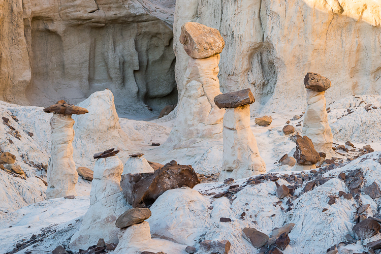
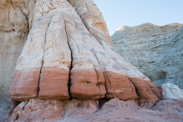

The Toadstool Hoodoos hike is out and back, a ballpark 1.7 miles depending on how far you venture around the area. The parking lot and trailhead are on Highway 89 about midway between Kanab, Utah and Page, Arizona. No permit required. The trail is very easy with minimal elevation change. Basically, you hike to an area with numerous hoodoos to see. Make sure you walk around the rock formations on the far-left side. Several white hoodoos, not otherwise visible, are found around the corner.
We first attempted to hike this trail on our second day in Kanab, which was very windy. After pulling into the parking lot, Stephanie opened her car door resulting in two immediate consequences. First, she got a face full of flying sand. Yum. Second, the driver’s door and entire front dashboard of the car got a dusting of sand. After Stephanie got her car door closed against the wind, and spit out all sorts of sand, we quickly called it a day and decided to return some other time.
Days later we hiked this trail late afternoon on a wind-free day, shortly before sunset. It was a relaxing and easy hour-long hike, definitely a must do in the area.
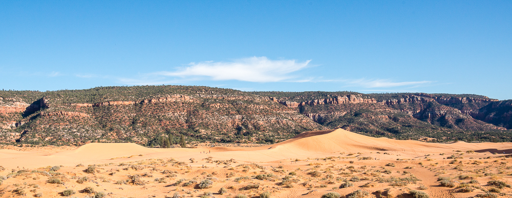
Coral Pink Sand Dunes State Park is about 20 miles west of Kanab off Highway 89. It is just as expected. Sand dunes, 1,200 acres of them. This park is an outdoor mecca for OHVs (Off-Highway Vehicles). You cannot miss seeing OHVs driving around and over the largest dunes. The only real negative with the OHVs is the sound of the engines.
Several companies offer OHV tours. It looks like fun, but not so much that I want to pay to ride through the dunes. A small part of the park is reserved for hikers, which is where we went.
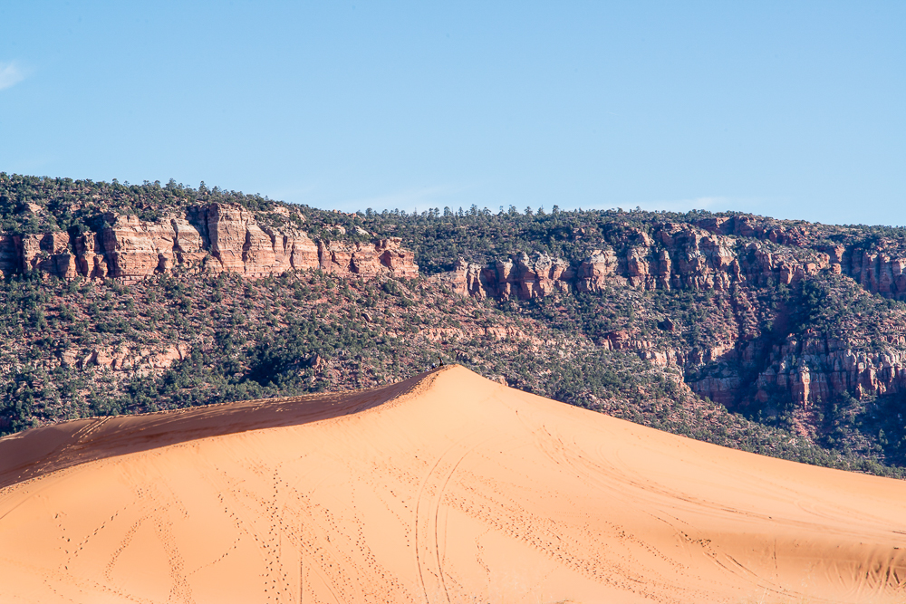
Sandboarding is another popular activity in the park. Think snowboarding, except on sand. Boards are available to rent. We saw a couple families with kids out in the dunes with boards trying their hand at it.
Looks like it would be fun going down a large 30 or 40 foot sand dune, but then you have to trek back up the sand dune to go again. There is no lift to give you a ride back to the top. So, no thanks.
Stephanie and I spent about 30 minutes walking through the dunes, which was more than enough time. We were not motivated to hike out to the largest dunes.
If you find large sand dunes interesting, want to ride an OHV, or perhaps try your luck sandboarding, then definitely stop by Coral Pink Sand Dunes State Park. If not, skip it. You won’t miss anything.
Miles Hiked:
The Wave: 7.0 miles (estimated)
Toadstool Hoodoos: 1.7 miles (estimated)
Coral Pink Sand Dunes State Park: maybe 150 yards (estimated)
Will we return to Kanab (or Page, Arizona)? I sure hope so. Coyote Buttes South, Buckskin Gulch, and Yellow Rock are still very high on the list of places to see.
After a month in Utah, it is time to head back to Memphis for the holidays, and to get ready for a return to Europe.
Garrett and Stephanie

1. We previously went to Toroweap on the north rim of the Grand Canyon and toured White Pocket with Dreamland Safari Tours. As with most of the awesome places in Vermilion Cliffs National Monument and Grand Staircase-Escalante National Monument, a truck with off-road tires is strongly suggested. And we do not have one.


To read other posts about our adventures in the National Parks and National Monuments, or elsewhere in the world, check out our Travel Blog. It contains collected links to all of our travel posts.
Want to subscribe (or unsubscribe) for email notification of new blog posts? It is only two to three emails a month. Send your name and email address to slowtravelchronicles@gmail.com, and note subscribe (or unsubscribe) in the subject line. All email address will be kept confidential and not sold to any third-party. You won’t get any marketing junk or sales pitches from us.

Very interesting as I had never heard of this area. Y’all are so good about sending great photos for us!
absolutely awesome! Thanks for sharing and going the extra “1/2 mile.” 🙂